Lofthellir in North Iceland: Natural Ice Sculptures in a 3,500 year old lava cave

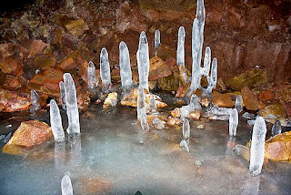
In the far north of Iceland lies a weird but beautiful world of ice and darkness. Enter Cave Lofthellir. Here, the underground boasts the greatest natural ice sculptures currently known in an Icelandic lava cave.

Lofthellir Cave - Ice Cave Tour

Lofthellir is a 3,500 year old lava cave that extends around 370 meters long and boasts formations that will leave you in awe. You can choose whether you want to start the tour from Akureyri or the Lake Myvatn area.

Lofthellir Cave - Ice Cave Tour

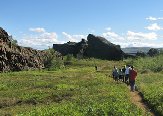
To get to the cave, you’ll drive to an area a mere 45 minute drive from Lake Myvatn. You’ll cross the unique volcano Hverfell, through the crater row of Lúdentarborgir to the roots of Mt. Hvannfell. After a 30 minute or so walk across a lava field, filled with unusual rock and landscape formations, you’ll arrive at a ladder made from rope which you’ll descend in order to enter the cave.

You’ll likely be given rubber boots since although it’s likely to be dry on your hike, you’ll need protection for your shoes once you enter the ice cave. Remember, it’ll be very wet inside.

Lofthellir Cave - Ice Cave Tour

Once you descend the ladder with your weatherproof gear on, you’re greeted with crystal clear ice before you make your way into the core of the cave itself.

After a few shallow chambers, you need to use a rope to get to the larger chambers, pulling yourself up along a slick area of ice. If you’re claustrophobic, then this may not be for you but if not, it’s certainly an adventure. On the way back, I recommend just sliding down the ice holding onto the rope while you do so – it’s one way to feel ten years old again in a split second.

Lofthellir Cave - Ice Cave Tour

The colors inside the cave are stunning – vibrant and surreal at the same time.

Lofthellir Cave - Ice Cave Tour

At one point while we were in the main chamber, our guide turned off all the lights and asked us to dim the flashers on our helmuts. Suddenly, we were completely in the dark with the only sound to be heard, a mere drizzle of water from an icicle above.

Lofthellir Cave - Ice Cave Tour

We sat quiet for many minutes listening to that soft drizzle and not uttering a word – silence meets serenity. It was a magical experience and something I’d recommend doing even if your guide doesn’t call for it.

lofthellir

Note: I did it with Visit Askja (info@visitaskja.com), a personalized adventure tour company that specializes in trips. All opinions expressed here are my own. I’d recommend taking one or more of their tours when you’re in the north of the country.

They have free hotel pick-up and departure time is 09:30am. This tour takes around 4-5 hours and the longest hiking time is 2x25 minutes.


This tour is not recommended or suitable for young children, people with claustrophobia or people that are not in reasonable physical condition. There is ice and water on the floor of the cave and the temperature inside the cave is around 0°C.

lofthellir

Iceland24
© 2015 Iceland24

Dettifoss waterfall travel guide, Iceland - Hiking trails at Dettifoss (west and east)

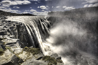
Falling 45 m with a width of 100 m, Dettifoss is reputed to be the most powerful waterfall in Europe. Visitors generally approach Dettifoss on the west side of the River Jökulsá where the road through Hólssandur is better. However, there are plans to improve the road on the east side. Please take care whichever route you chose.

Dettifoss waterfall travel guide, Iceland - Hiking trails at Dettifoss (west and east)

On the eastern bank, the footpath down to the falls is extremely rough and a number of accidents have occurred when visitors have strayed from the track. The grassy slopes on the western bank become extremely slippery when they are wet.

Dettifoss waterfall travel guide, Iceland - Hiking trails at Dettifoss (west and east)

Selfoss is a smaller waterfall a little way upstream with a drop of 10 m. There are easy paths from Dettifoss, which allow a pleasant 1 km walk.

Dettifoss waterfall travel guide, Iceland - Hiking trails at Dettifoss (west and east)
Selfoss waterfall
Below Dettifoss, the Hafragilsfoss waterfall cascades 27 m into a deep canyon. It is best to drive to Hafragilsfoss, which is located in an environment that is geologically and historically as fascinating as Dettifoss.

Dettifoss waterfall travel guide, Iceland - Hiking trails at Dettifoss (west and east)
Hafragilsfoss waterfall
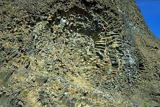
Some years ago, plans were proposed to harness the hydroelectric potential of the canyon, but they were scrapped when the lava strata in the area were found to be too porous for a reservoir. On the east bank of the canyon, near Hafragilsfoss, the river has cut through a crater row named Randarhólar to expose a volcano's lava pipe in the cliff wall

How to get there

Road 864 (east)

Road 864 goes from road 1 to Dettifoss on the east side. This is a gravel road and driving speed depends on road conditions each time. Road 864 is closed during winter time due to snow or wet conditions (muddy road) and does not open until early summer (end of May). Distances on road 864: Road 1 - Dettifoss: 32 km

Road 862 (west)

Road 862 is on the west side of river Jökulsá. Road 862, from Dettifoss south to road 1, on the west river bank, is a new, paved road which is passable for all vehicles. The road is not in service every day during the winter time and is often closed during snowy periods.  Distances on road 862: Dettifoss - road 1: ~ 20 km; Dettifoss - Mývatn: ~ 50 km


Hiking trails at Dettifoss (west bank)

The numbers of the hiking paths are in accordance to the number of the paths on the hiking map. Note that at crossroads out in the field these numbers are not at sign posts.

D-1 Dettifoss 
Distance: 1,5 km (back and forth) 
Walking time: 0.5 -1 hr 
Starting point: Dettifoss parking area 
Route difficulty: Easy route (blue)

Dettifoss is the most powerful waterfall in Europe. Its enormous power can be felt if you lay your hand on a rock close to the waterfall, it vibrates! Slowly the river digs its way through the waterfall´s edge and each year Dettifoss moves half a meter to the south. From the car park to Dettifoss is a 1 km walk (one way). It is possible to go the same way back.

Dettifoss waterfall travel guide, Iceland - Hiking trails at Dettifoss (west and east)

Warning: The spray from the waterfall goes mostly to the west side of the riverbank, over stone platforms and hiking trails. The area close to the waterfall is therefore really wet, paths can be slippery and visitors have to take special care. During winter time and frost periods heavy piles of ice can form and visitors should not go close to the rim of the canyon.

Dettifoss waterfall travel guide, Iceland - Hiking trails at Dettifoss (west and east)

D-2 Dettifoss and Selfoss
Distance: 2,5 km (circle) 
Walking time: 1hr 
Starting point: Dettifoss parking area 
Route difficulty: Easy route (blue)   

Contrasting landscape is one of the main characteristics of Jökulsárgljúfur. This trail reveals the most powerful waterfall in Europe, Dettifoss, against the humble and beautifully shaped Selfoss waterfall. From the parking area to Dettifoss is a 1 km walk (one way). It is possible to go the same way back. However, it is interesting to keep on south, along the riverbank towards Selfoss and then go the more westerly route back to the parking area and close the circle.

Dettifoss waterfall travel guide, Iceland - Hiking trails at Dettifoss (west and east)

D-3 Hafragil lowland 
Distance: 9 km (circle) 
Walking time: 3 hrs 
Starting point: A small parking area east of Hafragil Route 
difficulty: Difficult route (black)  

Warning: Steep trail, large boulders, risk of falling rocks.

The area in and surrounding Hafragil lowland contains the most difficult but also the most facinating hiking trails in Jökulsárgljúfur and caution should be exercised. The route to the Hafragil lowland starts at a small car park by the turn off to Hafragil waterfall. From there you go east towards the river and you approach the lowland via Sanddalur. There is a fixed rope to help you down a rocky section.

Dettifoss waterfall travel guide, Iceland - Hiking trails at Dettifoss (west and east)

Next you have to descend a steep and rocky slope and then the walk continues past the majestic Hafragil waterfall and through a rocky landslide along a small cove, Fossvogur, under a vertical rock face. This trail is not for people afraid of heights. The route back up takes you into the Hafragil gorge, following sheep tracks up the slope. When up at the rim you head south and follow the Hafragil gorge on the west side until back at the small car park.

Hiking trails at Dettifoss (east bank)

Hafragilsfoss
Distance: 0,5 km (back and forth) 
Walking time: 30 minutes 
Starting point: Hafragilsfoss parking area 
Route difficulty: Challenging route (red)  

From Hafragilsfoss parking area is a short walk to Sjónnípa, the crater where an ancient volcano's feeding dyke can be seen. From there is a great view over Hafragilsfoss waterfall as well as the river gorge. This is the deepest and most terrifying part of the gorge, which is around 100m high in the area. People are not adviced to go down to the lowland by the waterfall.

Dettifoss waterfall travel guide, Iceland - Hiking trails at Dettifoss (west and east)

Hafragilsfoss - Dettifoss - Hafragilsfoss 
Distance: 5km (back and forth) 
Walking time: 1,5 – 2 hours 
Starting point: Hafragilsfoss parking area 
Route difficulty: Challenging route (red)

A parked path leads from Hafragilsfoss waterfall, along the river gorge and to the Dettifoss parking area. This hike offers a great view over the river gorge.

Dettifoss waterfall travel guide, Iceland - Hiking trails at Dettifoss (west and east)

2 days trip HIKE 
A hike from Ásbyrgi to Dettifoss  

Hiking up along the Jökulsárgljúfur canyon, from the luxuriant Ásbyrgi to the barren but magnificent environment around Dettifoss, is a unique experience for every hiker. The diversity of the landscape is unique and captures the eye at every footprint: tremendous gorges, quiet ponds, clear springs, rough river, luxuriant forests and bare gravel plains.

Dettifoss waterfall travel guide, Iceland - Hiking trails at Dettifoss (west and east)

Distances:
  • Ásbyrgi - Dettifoss, total: 32 km (shortest way) 
  • Ásbyrgi - Vesturdalur: 12 km or 13.6 km (see route description) 
  • Vesturdalur - Hólmatungur: 8 km 
  • Hólmatungur - Dettifoss (along Hafragil): 11.5 km 
Hiking map 

Here is a hiking map of Jökulsárgljúfur: [pdf 1.8 MB]

Route description 

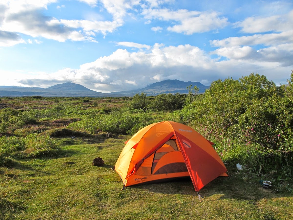
It takes two days to hike between Ásbyrgi and Dettifoss and normally lodged in Vesturdalur (Hljóðaklettar). The route can be walked in both directions (start ingeither in Ásbyrgi or Dettifoss). In Jökulsárgljúfur it is only allowed to camp at the official campsites in Ásbyrgi, Vesturdalur and at Dettifoss (a small campsite with few facilities).

Dettifoss waterfall travel guide, Iceland - Hiking trails at Dettifoss (west and east)

From Ásbyrgi to Vesturdalur there are two paths to choose from: One is to follow the rim of Ásbyrgi, and go south along Klappir and Kvíar, just over 12 km. The other route is to go the easterly path, closer to the river, but that route is 13,6 km long. Both routes start at the Visitor Centre in Ásbyrgi.

From the Visitor Centre, there are two ways to access the rim of Ásbyrgi. An easier way is to go east over the golf course and turn south at the intersection east of the golf course. From there the path goes up the lowest part of the cliff. A more difficult way is to go directly south from the Visitor Centre, towards the intersection at Tófugjá. There, turn east and go up the cliff, where there is a rope for support. It is not recommended to go this way if people have a heavy burden. Up at Tófugjá it is possible to choose which way to go to Vesturdalur (along the rim of Ásbyrgi or along the Jökulsá river).
Dettifoss waterfall travel guide, Iceland - Hiking trails at Dettifoss (west and east)

The route between Vesturdalur and Hólmatungur is about 8 km. The only river that has to be waded during the hike, Stallá, is at this section. Stallá is a spring river that flows into the Jökulsá river. The river is shallow and cold, but wading restores tired legs and makes the trip more memorable.

Dettifoss waterfall travel guide, Iceland - Hiking trails at Dettifoss (west and east)

From Hólmatungur there is roughly a 10 km hike south to Dettifoss, if you go into the Hafragil lowland (black route).  If you go along the Hafragil ravine the route is 11,5 km. It is not recommended for people with a heavy burden to go down to the lowland. In that case, hikers are advised to go to the campsite at Dettifoss, ease the burden and then explore the lowland.

Accommodation 

On the route there are no cabins and it is only allowed to camp on the park campsites. In Vesturdalur there is a beautiful camp site. There are toilets and running, cold water, but no shower facilities. Please contact the rangers before camping. At Dettifoss there is a small camping area, only intended for hikers. The area is just north of the parking lot. There is no running water at the campsite, but rangers bring fresh water to the site every day. Please use the water spaerly.

Dettifoss waterfall travel guide, Iceland - Hiking trails at Dettifoss (west and east)

Drinking water 

  • Between Ásbyrgi and Vesturdalur there are no streams or springs to take water from. Hikers have to carry all fluids with them. 
  • In Vestudalur there is running water in the toilet buildings. It is not recommended to drink water from the spring river due to high traffic of people in the area during the summer. 
  • In Hólmatungur there ​​are a lot of streams from which is safe to drink water. 
  • Between Hólmatungur and Dettifoss the only spring river is down in Hafragil.   
  • At Dettifoss there is no running water. Park rangers carry water in tanks to the campground. Hikers are kindly requested to moderate the use of that water.

Dettifoss waterfall travel guide, Iceland - Hiking trails at Dettifoss (west and east)

Obstacles on the route 

The trail is mostly easy. The main obstacles on the route are:  
  • Tófugjá in Ásbyrgi is the way that goes up the rock wall of Ásbyrgi canyon. There is a ladder and rope for support. You can choose another way to get up to the rim. See route description. 
  • Stallá is the only river that has to be waded. It is shallow and cold but not a major obstacle for hikers. 
  • Hafragil lowland is the most difficult trail in Jökulsárgljúfur but also the most magnificent. People who carry heavy burdens, are advised not to go down to the lowland, as the path is really narrow in some areas. In Sanddalur the trail is really steep and there is a rope for support to go up/down. Furthermore, the trail goes along large boulders and there is a danger of falling rocks. For those who carry heavy burdens and want to explore the lowland it is better to go all the way to the campsite at Dettifoss, leave the luggage there and then walk back down to the lowland. Those who are afraid of heights are also not advised to go this route.

Dettifoss waterfall travel guide, Iceland - Hiking trails at Dettifoss (west and east)

Travel opportunities 

The trail from Ásbyrgi to Dettifoss is a one-way route. Hikers need to have plans to get back from the endpoint. There are two companies that offer regular transport between Ásbyrgi and Dettifoss, SBA and Fjallasýn. SBA offers daily tours between Dettifoss and Ásbyrgi from the 18th of June to the end of August. For more information, visit the SBA website. On reauest, the company Fjallasýn offers transport and/or guided tours between Ásbyrgi and Dettifoss. For more information visit the Fjallasýn website. The school-bus driver Guðmundur Þórarinsson also offers service to hikers and tourist, tel: 892-8928.

Dettifoss waterfall travel guide, Iceland - Hiking trails at Dettifoss (west and east)

If you prefer a guided tour to Dettifoss, we recommend you this company.

Johanna, Iceland24

The Golden Circle - A best of Iceland in one day

The Golden Circle is Iceland's most popular sightseeing tour - and for good reason! In one day you‘ll get to see a magnificent waterfall, the world's oldest parliament and a hot spring area where the famous Geysir resides.


The name Golden Circle might be a tourist-industry tag, but it’s also apt, as this broad circuit east from Reykjavík covers many of Iceland’s best-known features and touches on the root of much of its history. The key area is Þingvellir, whose dramatic and geologically unstable rift valley marks where the Icelandic state sprang into being in Viking times. 

Iceland Golden Circle - The Golden Circle Day Tour

South from here is the religious centre of Skálholt, where Iceland’s last Catholic bishop was assassinated in 1550; while travelling northeast takes you past the spa town of Laugarvatn to Geysir, the original hot blowhole that has lent its name to similar vents worldwide, before sealed roads end on the edge of Iceland’s barren interior at Gullfoss’ thundering twin cataracts.

Þingvellir National Park

Þingvellir (Thingvellir) is the National Park where the Althing, an open-air assembly representing the whole of Iceland, was established in 930 and continued to meet until 1798. Over two weeks a year, the assembly set laws - seen as a covenant between free men - and settled disputes. The Althing has deep historical and symbolic associations for the people of Iceland. 

Iceland Golden Circle - The Golden Circle Day Tour

The property includes the Þingvellir National Park and the remains of the Althing itself: fragments of around 50 booths built from turf and stone. Remains from the 10th century are thought to be buried underground. The site also includes remains of agricultural use from the 18th and 19th centuries. The park shows evidence of the way the landscape was husbanded over 1,000 years.

Diving is permitted in two submerged rifts in the Park, Silfra and Davíðsgjá. Silfra is one of the best spots for diving in Iceland and many people find the rift unique on an international scale

Iceland Golden Circle - The Golden Circle Day Tour

Camping in Þingvellir

Camping is only permitted in two areas in the National Park. At Leirar, which is within a 5 minutes walking distance from the Information Center, and in Vatnskot, by lake Þingvallavatn. At Leirar there are four camping grounds: Fagrabrekka, Syðri-Leirar, Hvannabrekka and Nyrðri-Leirar. The Vatnskot camp ground is situated at an abandoned farm site by the lake.

Iceland Golden Circle - The Golden Circle Day Tour

Geysir

Geysir, sometimes known as The Great Geysir, is a geyser in southwestern Iceland. It was the first geyser described in a printed source and the first known to modern Europeans.

The English word geyser (a spouting hot spring) derives from Geysir. The name Geysir itself is derived from the Icelandic verb geysa, "to gush", the verb from Old Norse. Geysir lies in the Haukadalur valley on the slopes of Laugarfjall hill, which is also the home to Strokkur geyser about 50 metres south.

Eruptions at Geysir can hurl boiling water up to 70 metres in the air. However, eruptions may be infrequent, and have in the past stopped altogether for years at a time.

Iceland Golden Circle - The Golden Circle Day Tour

Gullfoss waterfall

Gullfoss is actually two separate waterfalls, the upper one has a drop of 11 metres and the lower one 21 metres. The rock of the river bed was formed during an interglacial period.

Water flows over Gullfoss at an average rate of 109 cubic metres per second. The heaviest floods have recorded a flow of 2000 cubic metres per second. During the summer the flow is 130 cubic metres per second, which would take only 3 seconds to fill this building. People were eager to exploit the power potential of Gullfoss and many plans for hydroelectric developments on the river Hvítá have been proposed.

Iceland Golden Circle - The Golden Circle Day Tour

Everyone that visits Iceland cannot miss the Golden Circle tour. But the ultimate question is whether you should visit the Golden Circle with a tour company, or self drive the Golden Circle in one day yourself? I highly recommend doing the latter.

What kind of rental car do I need in Iceland?

Depending on the time of year you go, and what your travel plans are, you should be fine just getting a small sedan.

Iceland Golden Circle - The Golden Circle Day Tour

If you are heading there in winter (November – March) you may want to consider picking up a 4×4. This is because some roads can be closed and the roads very icy/snowy. Just check the Iceland road conditions on this official website before you head out.

How to get there

There are several different ways to start the Golden Circle, including of course the option to drive clockwise or anti-clockwise. Here's a map for reference.

Generally it is better to drive clockwise and to begin by taking Route #1 (east) in the direction Vík, but just to the edge of Reykjavík, then turning north (left) onto the 431 and 435. 

Iceland Golden Circle - The Golden Circle Day Tour

Johanna & Petrea, Iceland24
July 2015

Akureyri Travel Guide, The Capital of North Iceland

For some time now we have wanted to write about the biggest town in Iceland, outside the Reykjavík peninsula. Akureyri is one of the places you´ll end up in if you are travelling around the island (the road ring or route 1 passes through it) and it were those visitors travelling that circle that inspired the writing of this article.

Akureyri

This precious town is located in the biggest fjord in Iceland (Eyjafjörður), surrounded by a beautiful mountain ring and enriched with many touristic attractions (but most of them are unknown to outsiders). With the help of Jóhanna, a local “akureyringur”, we got a detailed guide through one of the most delightful places of the island.

History

The town received its first municipal rights in 1786 but lost it in 1836. In 1862 the town regained its right and from then it started growing for real. In the 19th century the town expanded rapidly and became an important industrial center, dividing itself in two different zones, the commercial traders living in the south (the most beautiful one today) while the working class built up the north area.

Akureyri

It´s an interesting fact that the area of the present town was once a Viking settlement, one of the most important remains of the Viking era in this place is a small bronze sculpture of the Norse thunder god Thor.

Akureyri


Places recommended in Akureyri and its surrounding

The botanic garden (Lystigarðurinn)

What do you think of visiting the most northern botanic garden on the planet? If yes, then you´ll find it in Akureyri. It´s located at the heart of the town offering a romantic stroll amidst amazing diversion of colorful flowers, especially recommended in the heap of summer.

The garden was established in 1912 by a group of women but today its own by the town. In it you can find almost all the flowers and plants existing in Iceland as well as over 6000 foreign species. We recommend after a walk to sit down for a coffee and cake at the coffee house “Björk” which is located in the middle of the garden. Here you´ll find a detailed plan of the place.

Akureyri

The botanic garden is open from the 1st of June until the 3th of September with the opening hours from 08.00 until 22.00 (free entrance).

The swimming pool of Akureyri

Even though there is couple of swimming pools in and around Akureyri, the one we like the most is a walking distance from the botanic garden, as well in the middle of the town. Going there after a stroll in the botanic garden is a fantastic way to finish the tour.

The swimming pool (called Akureyrarlaug) is almost completely outdoor and has alot to offer in terms of relaxation and of course, exercise.  There are two big swimming pools, a splashpool for the little ones, 4 hot tubs (each being at different temperatures), steam bath, 3 water slides, an extensive area for sunbathing and a perfect artificial waterfall to relax your back and have a natural water massage. All the pools are heated by natural geothermal water and the temps range from a pleasant 27°C to the hottest pot at 42°C.

Akureyri

The swimming pool of Akureyri is open all year around and you can rent both swimsuits and towels. Weekdays it´s open until 21.00 and to 19.30 at weekends.

The Christmas house (Jólagarðurinn)

Located 10 km south of Akureyri, this adorable little Christmas garden and a store are open all year around and has an amazing variety of decorations, local handicrafts, ornaments and sweets all related to Christmas.

Akureyri

The outside of the red house resembles a house made of cookies and inside the decoration is impressive. Around the house there is a beautifully decorated garden, ideal for picnic. It even has a fairy tale tower which hosts the world´s biggest Christmas calendar (makes it worth climbing the stairs).

Traditional Icelandic houses (Laufás)

You´ll find these farmhouses just 20 minutes with a car from Akureyri and they are considered as a prototype of the old traditional Icelandic architecture. The oldest house still standing was built in 1840 but there has also been a church located at Laufás since the earliest period of Christianity in Iceland.

What immediately calls for an attention are the roofs of the houses which are covered with grass but that gave a “natural isolation” against the cold. At times, there was between 20 and 30 people living in Laufás and the last inhabitants lived there in 1936.

Akureyri

Now the houses are maintained as a museum as well as you´ll find a restaurant and a souvenir shop. The museum is open every day from 09.00-18.00 (from 15th of May until 15th of September). On Thursdays they have open until 22.00.To get to Laufás you´ll have to take route 1 in the direction east and take the exit 83 in the direction to Grenivík. You can see Laufás from the road (it´s easy to reach). 

The ski resort (Hlíðarfjall)

Without a doubt this is one of the best places in Iceland to practice this winter sport. The mountain rises above the town and the view up there is breathtaking. There you can do downhill skiing and cross country skiing, snowboarding or whatever you feel like with over three ski lifts to take you up the mountain. You don´t need to bring your own equipment, you can rent all of it there.

Akureyri

Hlíðarfjall is situated 500m- 1000m above sea level so in the winter there is alot of snow, an ideal condition for skiing. It´s only 5 km from the town and it is usually open from early december through april, depending on the amount of snow each year. You can see the opening hours in the following link and the price list here.

The forest of Akureyri (Kjarnaskógur)

South of the town, just above the airport, you´ll find Kjarnaskógur, a small but perfect place for an afternoon stroll, picnic or just to relax with your family. There are plenty of small routes all over the proximately 600 acres and it´s estimated that there are around 1 million trees in the area, many of them planted in the last 50 years.

Akureyri

There is one simple route of 7km that we recommend as well as another 10km designed for mountain bikes. There are also two playgrounds, picnic areas, barbecue facilities, toilets and a volleyball court. For bird lovers, it also has a rich wildlife and even a bird sanctuary.

Grímsey

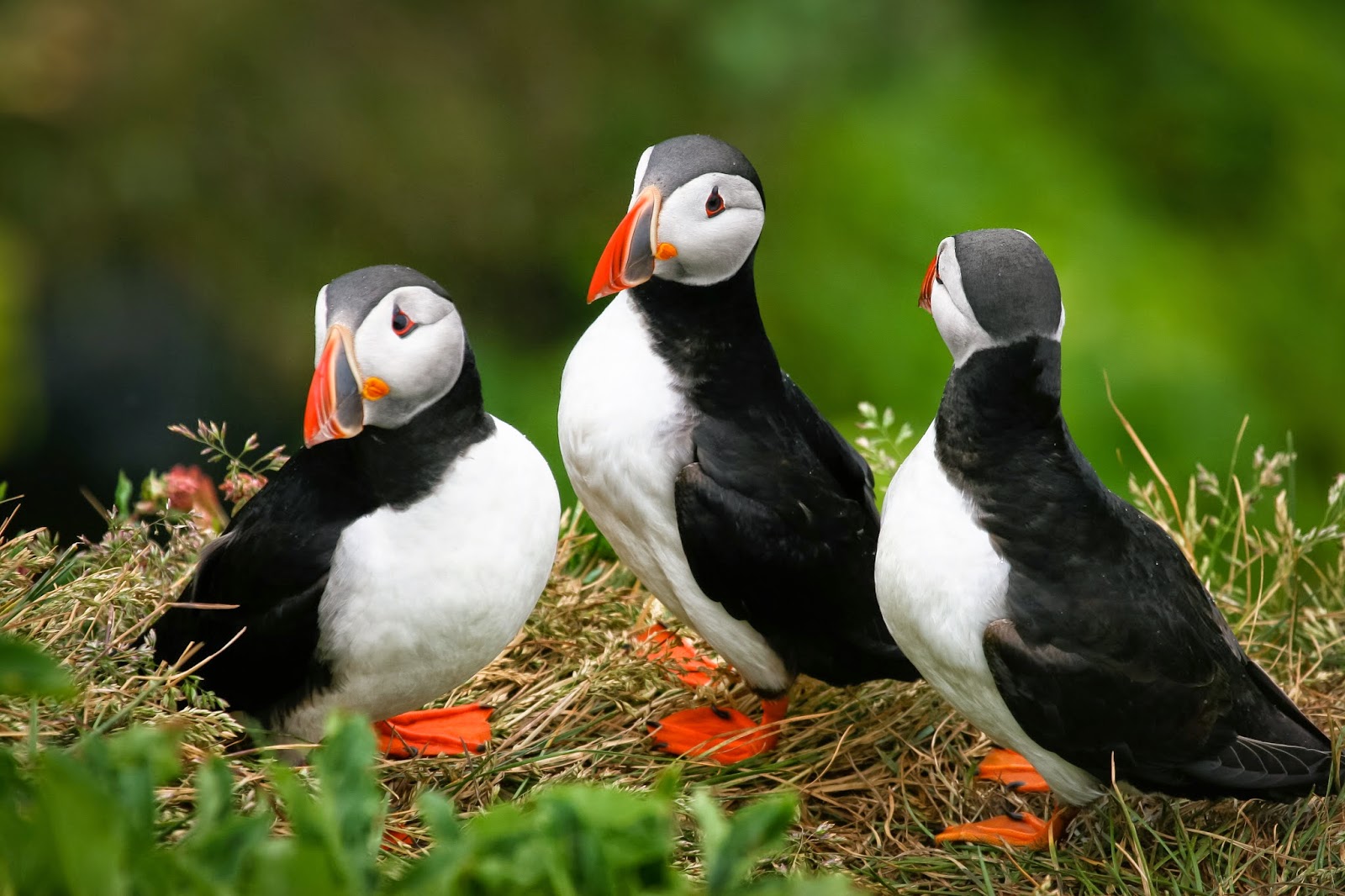
Even it´s not located in Akureyri, we cannot help to mention Grímsey, an island located 150 km north of Akureyri, a place totally recommended for bird lovers, especially lovers of puffins. On this island there are cliffs filled with thousands of these tiny cute birds. It´s an unique experience to see that island.

Akureyri

There is a direct flight connection Akureyri - Grímsey but it´s also possible to take a bus + boat to get there. We already have a more detailed article about Islands of Iceland which you can find here.

Where to sleep?

In Akureyri there are plenty of hotels, guesthouses and hostels to pass the night but we would like to make one special suggestion: Elf Guesthouse.

This is a guesthouse run by an elderly couple on the other side of the fjord (about 2 km from the town center) but they have built a gorgeous little wooden hut in a small forest next to a big stone which is said to be the home of an Elf.

Akureyri

If we are not mistaken, the Elf Guesthouse only has one other house nearby where the Icelandic couple lives in their own land of 200 square meters. According to Karl (the owner and a local carpenter), when they bought the land one of the condition that the seller made was that they would not “disturb” the elf nor built on or demolish the stone.

Akureyri

That promise they have kept, a garden around the stone is beautifully kept with lovely trees, flowers and ornaments. This place is the most romantic and amazing that you can imagine it´s like a small paradise. It only offers the possibility of renting the house to a couple. Direct contact with Karl is info@elfguesthouse.com

Where to eat?

Even though it may sound unbelievable there are many dining options in this small town of 18.000 inhabitants, all with different taste and budget. We will recommend four places we think are interesting for several reasons:

Bautinn. This restaurant is right in the town center and offers a classic menu for medium price. We recommend trying out the horse meat but all the main dishes come with a soup and a salad bar.

Rub23. This is the best restaurant in Akureyri and one of the top 5 in Iceland (the owner has another restaurant in Reykjavík). Here all the food is of high quality, an excellent wine menu and we highly recommend trying their specialty: sushi pizza.

Akureyri

1862 Nordic Bistro. Located in the cultural center HOF and offers a magnificent view with dishes and food typical of Denmark.


Strikið. Situated at the 5th floor, next to the main street of Akureyri. This place has a nice lounge atmosphere, quality food, good wine and gorgeous view. What more do you need?

Akureyri

To top it off here we have a link where you can view schedules of different activities, restaurants, museums, transportation, travel agencies, supermarket, drug stores, ice cream parlors and cafes in Akureyri. There were so many other places we could have mentioned but we don´t want to overdo it. What a piece of an article!

Kolla and Jóhanna
© 2015 by Iceland24