Showing posts with label tour. Show all posts

Photography in Iceland - A Snapshot of Nature

You've framed the composition. Jagged volcanic rock formations are silhouetted against the crystal glacier horizon. Looking up from the viewfinder of your SLR, reality is confirmed; you are standing shrouded in the ethereal glow of the emerald and violet Northern Lights.

Photography in Iceland - A Snapshot of Nature

Snap!

It's little wonder why Iceland is seen as the photographer’s paradise. For the seasoned professional or the so inclined amateur enthusiast, there is no shortage of subject matter. With contrasting landscapes covering the island, each one more breathtaking than the last, Iceland is a photographer’s dream destination; from the charming small town islands of Vestmannaeyjar, to the enchanting scenes of nature at the Golden Waterfalls of Gullfloss, your individual photography fairy-tale awaits.

Photography in Iceland - A Snapshot of Nature

Iceland itself is a unique mix of cultures and traditions that have been refined by a beautiful, yet demanding, landscape. Those who visit cannot help but want to capture a small piece to take home with them. Even those who aren’t normally ‘shutter bugs’ suddenly find a desire to pick up a telephoto lens, a small pocket digital shooter or even a phone, to capture one of the many scenes that touch their imaginations.

Memories preserved on film serve to awaken the spirit of adventure in every naturalist and call one back to the island’s majestic scenes (even for a second to third visit).

Photography in Iceland - A Snapshot of Nature

Inspired photographers of all skill levels set out into the wilds of Iceland to capture that perfect shot. Iceland may be small, but it has so much to offer in terms of variety. The unique and simple beauty on the island gives photographers the chance to shoot assorted subjects that are suited to every individual’s photographic flare; scenes of nature, wildlife, culture, midnight sun, Northern Lights… you’ll be sure to find your picturesque opportunities in Iceland!

Photography in Iceland - A Snapshot of Nature

Some quick facts! Iceland has very few trees, making unimpeded wide shots featuring wild, rocky terrain commonplace. Around 11.5% of the country is covered in glaciers. Amazing glass-like structures protruding from the foreground and cascades of ancient ice slides rolling through the mountains are some of the more remote, yet fantastic scenes on the island nation.

In summertime, specifically in June and July, the island experiences 24 hours of day light. The merging of sunrise and sunset make for some magical images of glaciers, beaches or waterfalls bathed in pink and orange light.

Photography in Iceland - A Snapshot of Nature

Wildlife

For wildlife photographers, Iceland boasts a rich birdlife. Puffins are exceptionally popular models. Stunning bird cliffs can be found around the country with breathtaking sunsets over the sea in the distance. The Icelandic horses provide a graceful subject, if not a tricky one; better snap fast, those ponies are quick!

Photography in Iceland - A Snapshot of Nature

Whale watching is a popular attraction that doesn’t disappoint. No need to take long trips out to sea, the huge water-dwelling mammals swim very close to the Icelandic coast. If you feel more like capturing images of domestic animals, there are also plenty of sheep and cows - in fact, the sheep outnumber the people 2 to 1! Of course, Iceland is also famous for Santa’s flying friends. Reindeer herds roam freely in some areas.

Northern lights photography in Iceland

In addition to Iceland’s night life, there are the “night lights”. The Northern Lights are another natural wonder that is unique to regions lying in the Arctic Circle. Streaking the night’s sky with vivid color, the Arora Borealis can best be seen in the winter months away from populated areas.

Photography in Iceland - A Snapshot of Nature

The sight of the northern lights were considered a sign of something sacred to the Norse people; seeing the breathtaking sight today, it is easy to see why.

Culture 

There is no place better for quirky images of culture, food, architecture or people than Reykjavík! It is known for its colorful houses, arts, great nightlife and a personality all of its own. The Icelandic population is a mix of Scandinavian as well as Irish heritage, which is reflected in their food, architecture, and character. Dotted around the coastline of the country are a few towns and numerous small fishing villages. Some are very remote and in idyllic settings. The traditional turf houses are small cottage structures covered with earth and make for a rustic, quaint picture.

Photography in Iceland - A Snapshot of Nature

Iceland’s individuality, diversity and remoteness are what make it such a desirable destination for the amateur or the professional photographer. From its natural wonders, to its animal life and the people who call it home, this island nation has so much to take in, and so much to capture on film. One thing is for sure, on your next Icelandic adventure, you shouldn’t forget your camera!

Photo tours and photo workshops in Iceland

Iceland24 can get you in touch with the talented Florent Gast (info@landmannalaugartours.com), a fully licensed tour operator in Iceland.

Florent Gast is a fantastic photographer that has years of experience in photographing Icelandic nature and both organizes photo tours and workshops in photography. The workshops are small and personal and include information about long exposure methodology, concepts of landscape photography, visual design and composition, working with filters, post processing for web and prints, basics of time-lapse and more.

Photography in Iceland - A Snapshot of Nature

All the pictures in this article (and most of the pictures on this website) are taken by Florent, many of them during photo tours, such as this one that appeared recently in The Icelandic Times.

Photography in Iceland
Rachel - Iceland24
July 2014

Lofthellir in North Iceland: Natural Ice Sculptures in a 3,500 year old lava cave

In the far north of Iceland lies a weird but beautiful world of ice and darkness. Enter Cave Lofthellir. Here, the underground boasts the greatest natural ice sculptures currently known in an Icelandic lava cave.

Lofthellir Cave - Ice Cave Tour

Lofthellir is a 3,500 year old lava cave that extends around 370 meters long and boasts formations that will leave you in awe. You can choose whether you want to start the tour from Akureyri or the Lake Myvatn area.

Lofthellir Cave - Ice Cave Tour

To get to the cave, you’ll drive to an area a mere 45 minute drive from Lake Myvatn. You’ll cross the unique volcano Hverfell, through the crater row of Lúdentarborgir to the roots of Mt. Hvannfell. After a 30 minute or so walk across a lava field, filled with unusual rock and landscape formations, you’ll arrive at a ladder made from rope which you’ll descend in order to enter the cave.

You’ll likely be given rubber boots since although it’s likely to be dry on your hike, you’ll need protection for your shoes once you enter the ice cave. Remember, it’ll be very wet inside.

Lofthellir Cave - Ice Cave Tour

Once you descend the ladder with your weatherproof gear on, you’re greeted with crystal clear ice before you make your way into the core of the cave itself.

After a few shallow chambers, you need to use a rope to get to the larger chambers, pulling yourself up along a slick area of ice. If you’re claustrophobic, then this may not be for you but if not, it’s certainly an adventure. On the way back, I recommend just sliding down the ice holding onto the rope while you do so – it’s one way to feel ten years old again in a split second.

Lofthellir Cave - Ice Cave Tour

The colors inside the cave are stunning – vibrant and surreal at the same time.

Lofthellir Cave - Ice Cave Tour

At one point while we were in the main chamber, our guide turned off all the lights and asked us to dim the flashers on our helmuts. Suddenly, we were completely in the dark with the only sound to be heard, a mere drizzle of water from an icicle above.

Lofthellir Cave - Ice Cave Tour

We sat quiet for many minutes listening to that soft drizzle and not uttering a word – silence meets serenity. It was a magical experience and something I’d recommend doing even if your guide doesn’t call for it.

lofthellir

Note: I did it with Visit Askja (info@visitaskja.com), a personalized adventure tour company that specializes in trips. All opinions expressed here are my own. I’d recommend taking one or more of their tours when you’re in the north of the country.

They have free hotel pick-up and departure time is 09:30am. This tour takes around 4-5 hours and the longest hiking time is 2x25 minutes.


This tour is not recommended or suitable for young children, people with claustrophobia or people that are not in reasonable physical condition. There is ice and water on the floor of the cave and the temperature inside the cave is around 0°C.

lofthellir

Iceland24
© 2015 Iceland24

Landmannalaugar travel guide

Landmannalaugar looks extremely Icelandic not because most of Iceland looks like this (it doesn’t), but because Iceland is practically the only place you will see landscape like this.

Landmannalaugar travel guide

The cascading ranks of bare-sided rhyolite mountains look a bit like a massive cake spackled with cream caramel icing, over which occasional streaks of garish food colouring have been indiscriminately flicked. It might be easy to believe for a while that this was the site of a huge industrial accident which has poisoned the land and killed it totally.

But it won’t take long to see through the lie, as the valleys and plains between the mountains are coated in lush grasses and meadow flowers; the slow-to-depart snow patches on the peaks are pearly white; the birds, tourists and other creatures are evidently in the peak of physical health; and the lakes, ponds, and rivers are pristine and pure.

Landmannalaugar travel guide

Organized tour or do-it-yourself?

We always recommend that you travel by yourself but in the case of Landmannalaugar we suggest that you book an organized tour if:

a) You want to travel in winter as it is impossible to do it with a normal 4x4.
b) You do not have a 4x4 vehicle (It is forbidden to drive to Landmannalaugar without a 4x4 car).
c) You have no experience driving on gravel roads and/or crossing river.
d) You are traveling with a motorhome or a camper.

Here is a link for a company that specializes in tours to Landmannalaugar.

Landmannalaugar travel guide

The rivers are hot, however – which is one of Landmannalaugar’s biggest attractions. The name Landmannalaugar could, in fact, be translated as Pools of the People, due to being such a fantastic (and free) place to bathe in natural warm water.

Landmannalaugar is in the Highlands and therefore not easy to get to – and totally inaccessible between roughly October and May. But one of the three ‘roads’ leading to this magical place is juuuuuust about suitable for normal two-wheel drive cars in the summertime. Although maybe not your own car, if you love it!

Landmannalaugar

There are limited facilities in the area, including huts to sleep in, a campsite, a very basic shop, and scheduled coach services passing through from time to time. This puts some people out of their comfort zone, while others find it all far too much. As probably the busiest and best-serviced place in the Icelandic Highlands, the former group will have to resign themselves to the fact that it doesn’t get any better – while the latter group can rejoice that it doesn’t get any worse.

Whichever group you fall into, Landmanna- laugar is a crazy and unique place you will want to visit at least once. Climb a red or purple mountain, see for many tens of kilometres in every direction, relax in the hot streams, revel in being in the middle of nowhere (even if there are a fair few other people there with you). Landmannalaugar is even allegedly the best place in Iceland to see the northern lights.

Landmannalaugar

The reason for this is that there is absolutely no ambient light pollution, that you absolutely have to be soaking in the hot water while gazing upwards, and that the colours and shapes of the lights match the landscape like nowhere else. Pure heaven! But it’s really only late August and September, when the area is still accessible and the nights actually get dark, that you’ll be able to indulge in this surreal pleasure.

How to get there

With a bus: There are daily tours to Landmannalaugar from Reykjavík from the middle of June to the middle of September. Departure from BSÍ (omnibus central station) at 8:30. There are also daily tours from Skaftafell. The busses stop for 2 hours in Landmannalaugar and leave to Reykjavík and Skaftafell around 14:30 (changable schedule!). In the mid summer there are scheduled bus tours between Landmannalaugar and Mývatn. Reservations are not necessary.  

Informations:
Tel. +354 77-444-77

Landmannalaugar

Driving a car: You can take your own car to Iceland with the ferry or rent a car in Iceland. Insurances do not pay for damaged rental cars on F roads (mountain roads). There are three main roads leading to Landmannalaugar. The easiest one is F 208 from the north, from the power stations. There are no rivers to cross, so a normal car will be enough, but be prepared for some shaking. You need bigger cars, with 4Wd for the other roads. The second easiest is F 225 from the west (close to mt. Hekla) and the third easiest is F 208 from the south (between Vík and Kirkjubæjarklaustur). Inform yourself about the weather because water in the rivers can differ a lot.  

Landmannalaugar

Landmannalaugar Tours: You can let experts do the driving and carry the responsibility (Day Tours every day; +354 776 76 76, www.landmannalaugartours.com). A Super Jeep Tour to Landmannalaugar cost around 38.000 ISK (summer and winter).

Some people hitchhike but that requires patience, since most drivers in the highlands are using all their space.

Biking: This is cheap but can be very difficult. Weather can be awful and some roads are so sandy that they are too loose to bike in. The sceduled busses can take bikes for reasonable fee. You use the same roads as the cars. Biking on the Laugavegur hiking trail is not forbidden, but only suitable for trained mountain-bikers, who can take care of not spoiling the tracks and the land.

Landmannalaugar

Hiking: Almost everyone who walks to Landmannalaugar follows the Laugavegur trail from Þórsmörk.   It takes 3 or 4 days and there are huts on the way. There are bus connections at both ends. Hiking daytours around Landmannalaugar are many and magnificent.

Where you can sleep

Camping: In the nature reserve area, you may only camp at Landmannalaugar, Landmannahellir and Hrafntinnusker. Outside the area you may camp anywhere where you don´t spoil anything. There are camping facilities where there are huts and there you have to pay something.

Hiking trail Landmannalaugar - Thorsmork

The total hiking distance is close to 53 km and the route from Thorsmork to Skogar on the south coast adds 24-26 km.

 The Landmannalaugar - Thorsmork route is called „Laugavegurinn", The Hot Spring Route, which is very appropriate. It is clearly marked between the huts in Landmannalaugar, Hrafntinnusker (Obsidian Skerry), on lake Alftavatn (The Lake of the Whooper Swans) and on river Sydri-Emstrua in Fremri-Botnar.

Landmannalaugar

The trail "Laugavegurinn" is one of the most popular and most travelled hiking trails in Icelandic wilderness. It is equally popular with domestic and foreign hikers. This is not without a reason as the trail offers a great variety of landscape. Mountains in almost every colour of the rainbow, great glaciers, roaring hot springs, big rivers and lakes. Generally the hike lasts four days and the starting point is Landmannalaugar (altitude approx. 600 meters) Overnighting is in huts but you have to supply your own sleeping bag. Those with confirmed reservations have a higher priority so it is important to look in aðvance if you want to have a certain place to stay.

1. day: Landmannalaugar-Hrafntinnusker 
Distance 12 km, estimated walking time 4 - 5 hours. Elevation increase 470 meters. 

From the hut in Landmannalaugar (75 persons, GPS 63°59.600 - 19°03.660) the trail goes through a rough lavafield "Laugahraun". From there on up the slopes of "Brennisteinsalda" and to the plateau. The view offers an incredible spectrum of colours. After 3 - 4 hours you arrive at "Stórihver", a hot spring and almost the only green spot visible in the first day. In most years the rest of the trail from "Stórihver" to "Höskuldsskáli" hut is covered with snow. Chances of fog are very high so even though the trail is clearly marked you must be careful. A walk to the icecaves (approx. 1.5km from the hut) is a must. The huts location GPS 63°55.840 - 19°09.700 and sleeps 36 persons.

Landmannalaugar

2. day: Hrafntinnusker - Álftavatn 
Distance 12 km, estimated walking time 4 - 5 hours. Elevation decrease 490 m. 

The first part of the trail takes us through a valley with some small ravines but be careful as they may be filled with snow. If the visibility is good a walk up to the top of mountain "Háskerðingur" (1281 m) will reward your with a breathtaking view. Soon we leave the colourful rhyolite mountains and enter an area with dark palagonite mountains and glaciers. You will also notice a considerable increase in vegetation. The trail down the "Jökultungur" is rather steep but leads down to a friendly oasis on the banks of river "Grashagakvísl" a fine place to rest for a while. From there on the trail to the two huts by the lake "Álftavatn" is on flat land. There are two huts (58 persons, GPS 63°51.470 - 19°13.640).

Landmannalaugar

3. day: Álftavatn - Emstrur (Botnar) 
Distance 15 km., estimated walking time 6-7 hrs., elevation decrease 40 m. 

The trail takes us over the ridge "Brattháls" into "Hvanngil" ravine, wading across the river "Bratthálskvísl". In "Hvanngil" are two huts, one built for sheepherders in 1963 and one for tourists, built in 1995. A short walk from the huts is the river "Kaldaklofskvísl" with a bridge for hikers. On the eastern bank of "Kaldaklofskvísl" the trail branches, one branch leading eastwards to "Mælifellssandur" (Road F 210) but the other one southwards to "Emstrur" and we choose the latter. Less than one km from "Kaldaklofskvísl" another river has to be waded and approximately 4 km further we come to the river "Nyrðri Emstruá" but this time there is a bridge to cross it. Soon we will be overlooking the huts in "Botnar" (40 persons, GPS 63°45.980 - 19°22.480). A fine walk in the evening is to the "Markarfljótsgljúfur" canyon.

Landmannalaugar

4. day: Emstrur (Botnar) - Þórsmörk 
Distance 15 km., estimated walking time 6-7 hrs., elevation decrease 300 m.

First we have to go around the canyon of "Syðri - Emstruá" and there is a very steep path down to the bridge so be careful. Then a walk through the area known as "Almenningar" with crossing of among other rivers "Þröngá". It is good practice when wading to go hand in hand and head downstream. After crossing "Þröngá" a 30 minutes walk takes us to the hut in "Langidalur" in "Þórsmörk" (75 persons, GPS 63°40.960 - 19°30.890) Landscape and vegetation is changing rapidly. Birchwood and all kinds of plants a welcome change after the desert now behind us. The hut in Thorsmork is Basar huts in Godaland, in Langidalur Hut Skagfjordsskáli and cottages and huts in Husadalur.

Landmannalaugar


Jóhanna Rós & Kolla
© 2015 Iceland24

Bárðarbunga Expedition

The views of the volcano from the plane were impressive to say the least. That was on the Saturday, the day of our arrival. It was on the Sunday, whilst enjoying lunch with some Spanish red wine that the real adventure began. It was an unexpected but most welcome twist to our journey that we will remember for the rest of our days.


At around 2pm we received a call from the Civil Protection Agency informing us that access to “point zero” was now permitted. We were not expecting this. In fact when we got the call we were planning our return trip to Reykjavik. Suffice to say we quickly finished eating and ran to the hotel to collect our belongings.

Time was of the essence, so we headed straight for the meeting point at Myvatn to find our contact Sindri, who would take us to the volcano. Sindri, a local expert driver-guide was as excited as we were. It was the first time he had the opportunity to experience a volcano at such close quarters.After checking all of our equipment, including dangerous gas sensors we jumped into the Super Jeep and headed off to the “giant in flames”.


The unpredictable nature and potentially devastating effects of volcanoes is something not to be taken lightly, and with the eruption of 2010 still fresh in our minds we approached the eruption site with no little amount of trepidation and fear. However, our relentless thirst for travel, our fascination of the volcano plus our commitment to report on the events helped to give us the impetus we needed to get there.


Less than an hour later we were in Moðrudalur, the last inhabited settlement before entering the maze of tracks that lead to the volcano. The possibility of a sub-glacial eruption flooding the valley that offered the most direct route, we were forced to take a diversion  through winding roads and lava fields from the east to the shelter of Askja. From here we would follow a new path that would lead us to Þorvalstindur and the eruption area.


The numerous police checks combined with the slow arduous going on the barely drivable tracks in this bleak arid landscape merely served to compound our frustration. Night was approaching and there was still another 35km to go. The glow of the clouds in the distant lent an apocalyptic feel to the proceedings. Fear, respect, excitement, impatience, apprehension, joy, curiosity – our team were experiencing a cocktail of emotions that somehow managed to unite us more than ever.


We finally arrived at Askja. We stopped at the hut there for a few minutes before the countdown could begin. Our journey to the gates of hell was almost over. Sindri accelerated as if possessed by demons as the engine of the 4X4 roared into action.Suddenly it was there. Expelling magma and smoke with a violent force that coloured the sky with dark foreboding shades of grey.


With a bright red dot on the horizon forming a strange almost surreal sunset that illuminated a seemingly infinite expanse of black sand, our indefatigable horse walked on. A glacier and a dark mountain completed this otherworldly landscape, and I felt like I was marching into a battle at the end of the world. My very own Ragnarrök.

Then it hit me. What if the activity at Bárðarbunga suddenly increases. What if a dreaded subglacial eruption floods the entire area that surrounds us? I glanced nervously at Sindri, and he sensed my unease. I ordered him to stop the jeep. We could feel the ground beneath us shaking. I asked him if he was sure we were doing the right thing. Without hesitation and displaying a bravado so typical of a Viking warrior he replied that we were. We took advantage of this brief pause to take pictures and videos just as it was getting dark.


Our desire to be as close as possible to the eruption spurred us on. We set off again, and 10 minutes later we were almost there. The darkness had made the glowing embers of the lava almost indistinguishable from the red lights of the few vehicles that were already there.


Finally there it was. The Volcano. It would be futile for me to even attempt to explain how I felt. There are simply no words. The excitement just flowed through my body and I could feel tears trickling down my cheeks. Pictures and videos can only go some way to describing the sensation of witnessing a volcano eruption. There is nothing that can truly depict what we felt. All I can say to you,  friends, readers and travellers is to believe me when I say that there is nothing more powerful or humbling than the unrestrained forces of nature.

How to get there?

Those of you wishing to travel to the area and take a flight can contact these companies:

Flight from Reykjavík (from 670€)
- Helicopter from Reykjavík (from 1.180€)
Flight from lake Mývatn (from 250€) Most popular: Recommended
Super Jeep Tour from lake Mývatn (from 220€)
Flight from Akureyri (from 360€)
- Helicopter from Akureyri (780€)

The cost per person is €250 from Mývatn, and the truth is this one is highly recommended (do not overpaid for this!).


Jóhanna & Kolla & Juan
Iceland24, September 2014
Þríhnúkagígur - Inside the volcano

Iceland’s Þríhnúkagígur volcano is thought to be the only place in the world where you can safely explore a volcano’s magma chamber…from the inside. Talk about an experience of a lifetime!


Lowered in a small skyscraper window washer’s pulley lift through a four metre wide hole, down, down, down nearly 150 metres (double the height of Hallgrímskirkja) onto a floor the size of a football pitch in a cavern 150,000 cubic metres by volume, which was once filled with pressurised molten lava waiting to explode upwards. Welcome to Þríhnúkagígur.


The volcano is the only place on earth where the magma chamber is accessible and currently safe to explore. The size of its chamber is enormous; the ground space is roughly the size of a football pitch. The distance from top to bottom is about 150 meters (450 ft.). Þríhnúkagígur last erupted over 4000 years ago.

This Icelandic volcano hasn’t erupted for 4,000 years, so you’re probably safe being inside it. But the frisson of danger is nevertheless pervasive and basely attractive.


Summer 2012 was the first time the crater was open to tourists – and even then only until mid-August. But if you’re lucky you might manage to get onto one of the 5-6 hour tours again in summer 2013, between 15th May and 10th September.


Plans to run the tours for a second summer were late to be revealed and there is no way of knowing if they will run in 2014 or not. Even if they don’t, there are plans afoot to tunnel directly – hopefully discreetly – into the crater and erect a viewing platform in coming years. While this would remove the thrill of the descent, it would allow more people to see the amazing site, and for a less exorbitant price. 

The Volcano is only approximately 30 minutes drive from Reykjavík. Once there, travelers must walk for 40 minutes across a lava field to reach the summit. Then they will take an open cable lift 120 metres down to the bottom of the crater before beginning the hour-long tour with a team of expert guides.

CNN rated Þríhnúkagígur number 13 on its 27 Must See Places Before You Die list…so it must be good!

Peter, June 2014
Iceland24

Jökulsárlón glacier lagoon in Iceland. An adventure you'll never forget!

Jökulsárlón is today one of Iceland's best known and most popular natural wonders, and for a good reason. A magnificent view welcomes you as you arrive there and it's almost like stepping into a fairy tale landscape.

Jökulsárlón (literally "glacial river lagoon") is a large glacial lagoon in southeast Iceland, on the borders of Vatnajökull National Park. Situated at the head of Breiðamerkurjökull, it evolved into a lagoon after the glacier started receding from the edge of the Atlantic Ocean.


The lake has grown since then at varying rates because of melting of the Icelandic glaciers. The lagoon now stands 1.5 kilometres away from the ocean's edge and covers an area of about 18 km2. It recently became the deepest lake in Iceland at over 248 metres depth as glacial retreat extended its boundaries.


The size of the lagoon has increased fourfold since the 1970s. It is considered as one of the natural wonders of Iceland. The lagoon can be seen along Route 1 between Höfn and Skaftafell. It presents a picturesque parade termed as “A ghostly procession of luminous blue ice-bergs through the 17 km2 Jokulsarlon Lagoon”. Jökulsárlón has been a setting for four Hollywood movies - A View to a Kill, Die Another Day, Tomb Raider and Batman Begins - A postage stamp depicting Jökulsárlón was issued in 1991 with a face value of 26 krónur.


The tongue of the Breiðamerkurjökull glacier is a major attraction for tourists. Tour operators conduct snowmobiles and jeep tours to visit the glacier along the winding iceberg studded Jökulsárlón Lagoon. The base station for visits to the area is at Joklasel, which is approached from Höfn. It is termed as Tourist Conveyor belt.


FAUNA

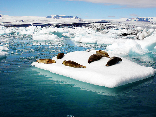
The lagoon is filled with fishes that drift in from the sea along with the tides. Seals gather in large numbers at the mouth of the lagoon to catch fish during the winter, which is a sight to watch. Large numbers of sea birds, particularly arctic terns, which nest nearby also gather to catch herring, trout, salmon and other fishes and krill.


LANDSCAPE

The white cap of Breiðamerkurjökull glacier dominates the lagoon and its icebergs. Jökulsárlón is separated from the sea by only a short distance, and the combined action of the glacier, the river that empties from the lake, and the ocean may eventually transform it into an inlet of the sea. There are plans to prevent this from happening, since the only road in the area passes over the narrow isthmus.


HOW TO GET THERE

Sterna (buses)
Jokulsarlon-Skaftafell
Reykjavik-Laugarvatn-Reykholt-Gullfoss-Geysir
Reykjavik-Hofn
Reykjavik-Hvolsvollur-Vik
Reykjavik-Arnes-Fludir
Vatnsmyravegur 10
101 Reykjavik
Tel.: 562-1011
bogf@bogf.is


More information about Vatnajökull Region
Jókulsárlón panoramic view

Berglind Rós
Iceland24
Mars 2014

Travel in Iceland: Europe's biggest national park is in Iceland

In 2008, Iceland embarked on a nature conservation project on a hitherto unparalleled scale with the establishment of the 12,000 sq km Vatnajökull National Park. Few if any regions in the world offer such a mixture of dynamic ice cap and outlet glaciers, geothermal energy and frequent subglacial volcanic activity, coupled with outburst floods.


Initially, the park will include some areas already under protection, such as the Skaftafell and Jökulsárgljúfur National Parks, Lónsöræfi wilderness and Vatnajökull glacier, which is larger than all the other glaciers in Europe combined. Already occupying about 12% of the country, the park boundaries are expected to expand in the coming months and years, so as to offer a unique opportunity to observe the wide-ranging impact of the Vatnajökull glacier on its surroundings, in which ice and fire play leading and often complimentary roles.


The park is the single largest nature conservation project the Icelanders have ever undertaken. Moreover, it marks one of the largest economic and rural development schemes that the government has implemented in Iceland. Tourists visiting this protected area will be able to observe the culture and history of the communities dotted around the glacier, which have learned through the ages to live with and utilise their volatile surroundings. The proximity to nature’s land-sculpting elements opens up boundless possibilities for research and study visits, and not least for experiencing the silence and solitude of the wilderness and thus feeling at one with nature.


Visitor Centres are the park’s core service facilities and will be based at the national park’s main entrance points. Two already exist and four more will be added (Campervan Sweden). They contain exhibitions and displays, provide information and host various cultural events, as well as housing the park wardens.

Wardens offer guided nature interpretation tours and children’s activities in different parts of the park, providing an insight into the area’s natural wonders, from volcanic eruptions and catastrophic floods at the grander end of the scale, to the delicate world of Iceland’s fragile flora and fauna.

Iceland24
May 2013